WHat options do we have, for example, the canadian portions of the great lakes and the Trent-Severn Waterway, to purchase charts. I do all my route planning on CE, I’ll need to purchase those charts for the loop this year.
I too have issues with non BC Canadian charts. Spent a butt load (appx $500) on the Lake Huron/Georgian Bay ENC group. I had expected the chart data to be as detailed as that found in printed charts (eg, TrakMaps #644) . They are is not. The amount of depth and ATON data in the Canada ENCs varies from OK to unusable. Although far from perfect, the C-Map charts are the best CE compatible charts I’ve found for this area.
Do they include the Trent Severn waterway? And how do we get them?
I purchased the Trent-Severn raster chart collection from the Canadian Hydrographic Services a few years back. I just checked and from what I can tell, these charts are now discontinued and have been replaced by vector charts. A few comments.
- I find navigating the Canadian chart purchase process confusing. You do not purchase directly - must go through an authorized dealer many of which have no clue they are an authorized dealer. Start here to find the charts you would like to purchase:
https://charts.gc.ca/charts-cartes/chart-index-carte-eng.html
Go here to find an authorized dealer:
https://charts.gc.ca/charts-cartes/dealer-depositaire-eng.html
I purchased my Georgian Bay set (V-CEN-A) from The Nautical Mind:
https://www.nauticalmind.com/
- The raster collection that includes the Trent-Severn (RM-CEN09 which is discontinued as mentioned above) is now included in the V-CEN-B vector collection which costs $1150 Canadian. The V-CEN-B collection includes lots of territory aside from the Trent-Severn. It appears that the entirety of the Trent-Severn is covered under a single chart (CA273096) in this collection and can be purchased for $50 Canadian. The scale of this chart looks humongous so I don’t know if it has any real navigation value. Unfortunately from what I’ve experienced you’re purchasing a pig in a poke as the only way to determine if it’s going to help is to purchase and upload into Coastal Explorer.
I’ll post some screen shots of the Trent-Severn raster charts and C-Map charts later.
Roy
1 Like
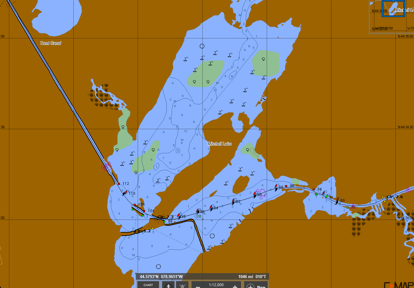
Here’s a comparison of the Canada Hydrographic Services raster chart and the C-Map chart for Mitchell Lake on the Trent-Severn. I think the C-Map charts are still available through the Coastal Explorer chart store link.

Thank you. Last I tried CMAP wasn’t working. I see it is now.