I’m trying to do a Sync and update. All starts correctly and the progress bar moves along. A little past the 3/4 point the bar stops and does not finish even if left for an hour or so. I tried this several times with the same result. I’m using an iPad Pro with latest IOS connected to very fast WiFi. I’m also signed into ActiveCaptain. Any idea if the problem is something I’m overlooking?
1 Like
I’m not sure what could be going wrong here… What are the area and layer options you are using (Settings > Charts and Add-Ons)? We’ll duplicate those here and see what happens.
I’m selecting a pretty big area of charts to save for offline use. Once I get underway I won’t have Internet to obtain the next segment of the trip. If I could download an entire region of ENC charts like on my PC that would be great, but I don’t think that’s possible.
I’m attempting that download right now…looks like it’s going to take a while. I’ll report back when it’s done (or seems to fail).
I’m going to guess it’s the NOAA RNC, though… That is a pretty big area for how those are delivered. You might try disabling that layer. (In fact, we are considering removing the ability to download the RNC completely given the problems it causes.)
You should be able to download a much larger area with only the NOAA ENC selected.
The RNC’s are not that big a deal for me on the ipad. I do use them on my PC especially before entering small harbors just as a double check to see if I missed something. I can do fine with only ENC charts on CE iPad. I’ll try disabling the RNC download as well and see what I get here.
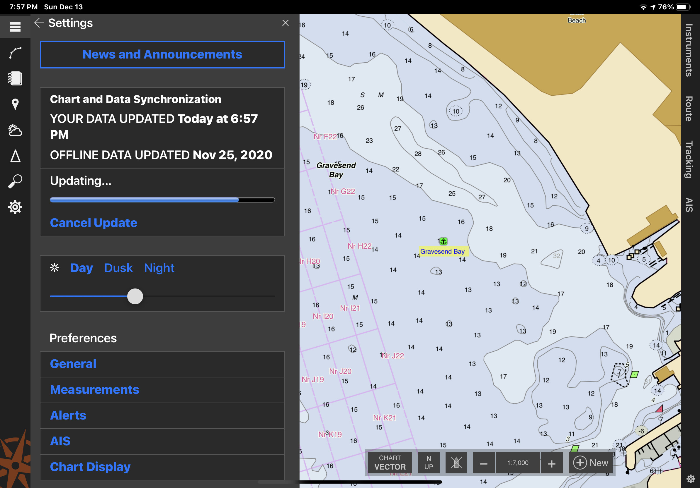
Tried the update without RNC’s selected and the update did complete, however it took over an hour. The iPad kept going to sleep during the process so not sure if that interferes with the download. Just before the end of the update download I got an error message as shown in the attached screenshot. I hit the “start update” button again and it zipped through and finished without a problem. My guess is an error was from the iPad going to sleep repeatedly during the original update attempt or maybe a corrupted chart?
The limitations for me using the iPad is being able to leave port with all the charts I’m going to need. Once I’m out of internet range I keep moving and may not have the opportunity to download more charts. Wish there was a way for me to collect all the charting I need while at home with fast WiFi.

It is possible that the iPad going to sleep caused that error. There are options for preventing your device from going to sleep on the “Settings > General” page. But as you found, another update will usually go quickly and should get you the rest of the data.
I’m not sure how much more chart you need, but you should be able to get it by expanding the selected area. If you change the area now, Coastal Explorer will only download the new parts; it won’t need to download anything you already have.
That’s interesting. So, by downloading more charts along the coast my past chart download remains? Is there a limit to how much area I can add? I thought a subsequent download deletes the previous one. My goal would be to add coastal charts from Chesapeake to Maine.
Coastal Explorer will download whatever data it can for the area and layers you select, so if you select a rectangle that covers everything from Chesapeake to Maine, it will download all available data in that rectangle. If you change the area later, it will download all available data in that new area and remove data outside of that area (eventually, the removal doesn’t happen immediately).
When Coastal Explorer is downloading chart data, it will only download data it doesn’t already have, so when you expand the area to download, it will only need to download data in the newly added parts of the rectangle. This is also true of getting updates when the area hasn’t been changed; only those parts of the chart that have changed will be downloaded.
Ok, I understand. I’m trying the Big rectangle now that covers ENC’s from Chesapeake to Maine. I also realized that if you first open a route and display it, you can use it as a guide for the size of your rectangle. I think this helps to keep the area as small as possible and only includes where your route goes.
I forgot to report back after trying to download your area… I selected the same area and all of the layers and started a download. It stopped after six hours and reported 157 errors. The errors were all cases of NOAA’s server not responding in a reasonable amount of time, so had to do with getting the raster chart data. I started another update and that time it took 24 minutes and there were no errors.
So I’m afraid I don’t yet know why your updates were stopping where they were, but it could have been caused by your iPad going to sleep. We’ll do some more testing around devices going to sleep during updates.
Have you been able to download your “Big Rectangle” successfully?
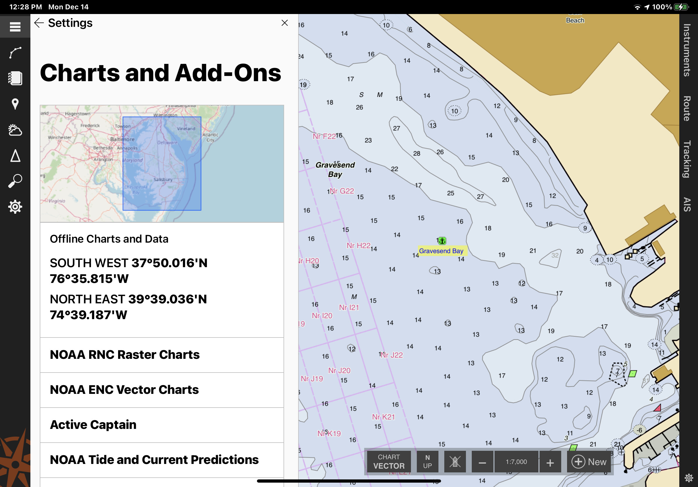
Yes, I did get a successful download. I first unchecked Raster charts. My Big Rectangle includes half of the Maine coast, south to the Chesapeake including all Long Island Sound, NYC and NJ coast. I did not time it exactly, but it took at least an hour with one error. A second sync went very quickly and no errors. It seems that after you get the bulk of your charts subsequent downloads zip through just fine.
It was good to know how the chart download works. If I completely change my rectangle I have to be sure I have a fast WiFi connection and time for the big download. Keeping the same rectangle and using sync is fast, but modifying it requires gathering the charts you didn’t previously download. A big modification equals more time to complete.
I’ll do a few smaller rectangles to see how that goes.
Still a problem!
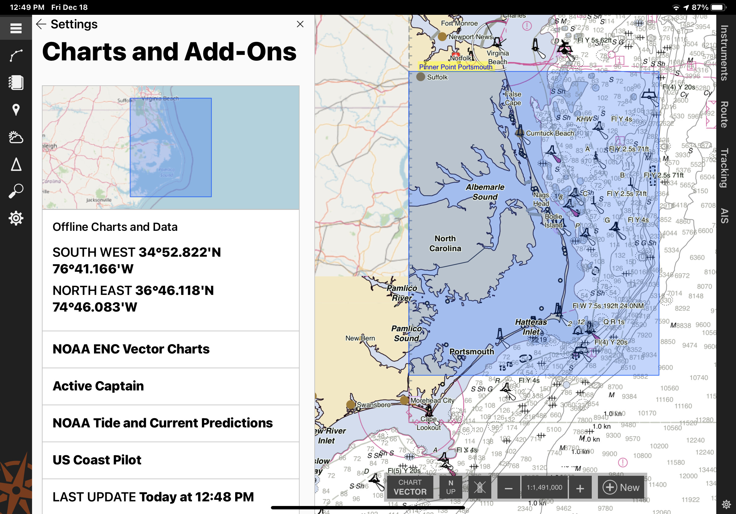
I created a smaller box going south of Virginia Beach, which is a totally new area of charts then I previously downloaded. When I hit “Start Update” the progress bar is already at 7/8 and not moving. The update lasts less then a minute but when I zoom in to see the offline downloaded Vector charts there are none in this new area. The old Big Rectangle of charts is still visible.
At what point does CE purge un-selected charts when a previous area is abandon and a new area added to the users offline chart download? Also, I unchecked Raster charts for all this. For the iPad, I’m happy just getting good, up-to-date, Vector charts.

Looks like we do have a problem when the rectangle is not selected in the expected direction. In this case, the western side of your rectangle is to the east of the eastern side. Coastal Explorer will be able to deal with that in the next update. In the mean time, if you swap the longitudes, or redraw the rectangle from the top-left to the bottom-right, you should get the right data.
Previously downloaded chart data that is not within the current area is not purged yet, unless the device is running low on space. We haven’t decided if it should stick around for some time in case you are fiddling with the download area, or if we should just delete it as soon as the downloads for a new update have finished.
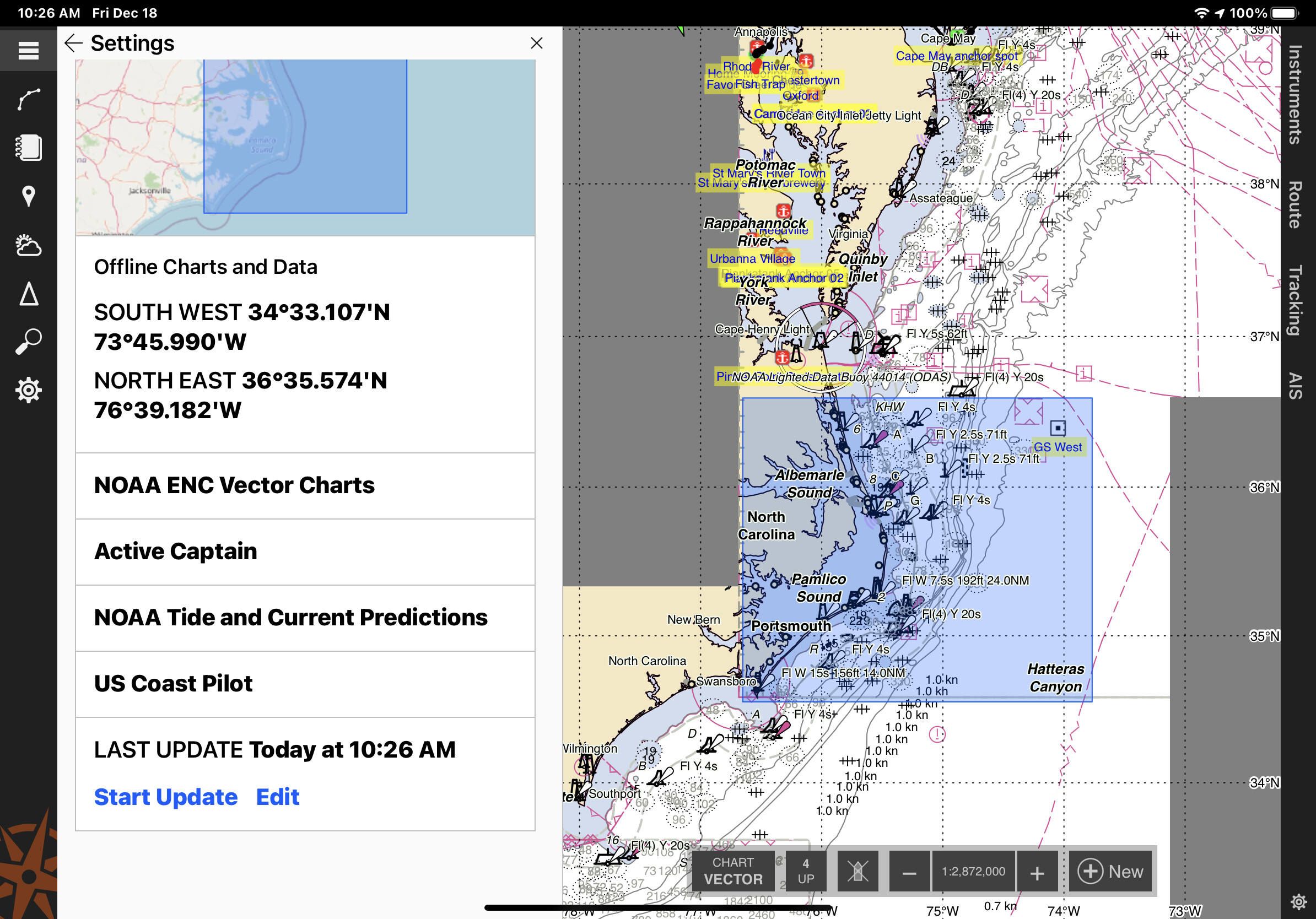
That worked. I switched the Longitude and that worked fine. The highlighted area in the screen shot took 13 minutes to download the charts and data.
As far as saving chart downloads go, I’m in favor of preserving as much chart as possible. In my opinion the app is only as good as the charts it can access and display. Some users will only need a small area and others who are not in cell range or have internet may need much bigger boxes. Once you take the time to get charts on the iPad I think it’s important to offer an option to keep them. Since I’m not a programmer I have no idea how hard that might be to implement. In any case, I know that in this version I can get all the coast I need for next summers sail.