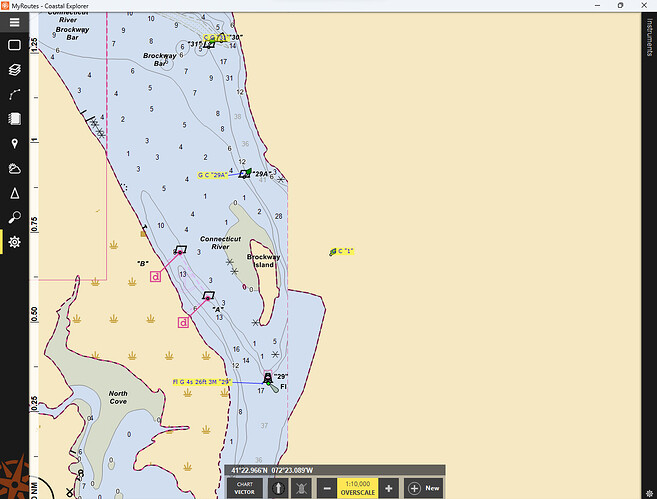
Hello! I can’t seem to be able to have vector charts show up for a few specific locations. For instance, on the Connecticut River, the old raster chart shows the entrance to Hamburg Cove in Lyme, Connecticut. However, when I switch to show vector charts, Hamburg Cove disappears and becomes solid land. Right-clicking in that area to show “Charts Here” only reveals two available vector charts, both of which are checked. I even unchecked one and then the other to see if that made a difference, which it didn’t.
Is there something I’m missing? I appreciate any assistance.
Nate
