I’m unsure which features will eventually be implemented but I did want to request that the ability to display info panels on vessels as in the older version. It’s quite helpful for watch changes and in heavy traffic.
1 Like
Having a stand-alone ETA List instrument panel without needing to use a route will be sorely missed if not in final version.
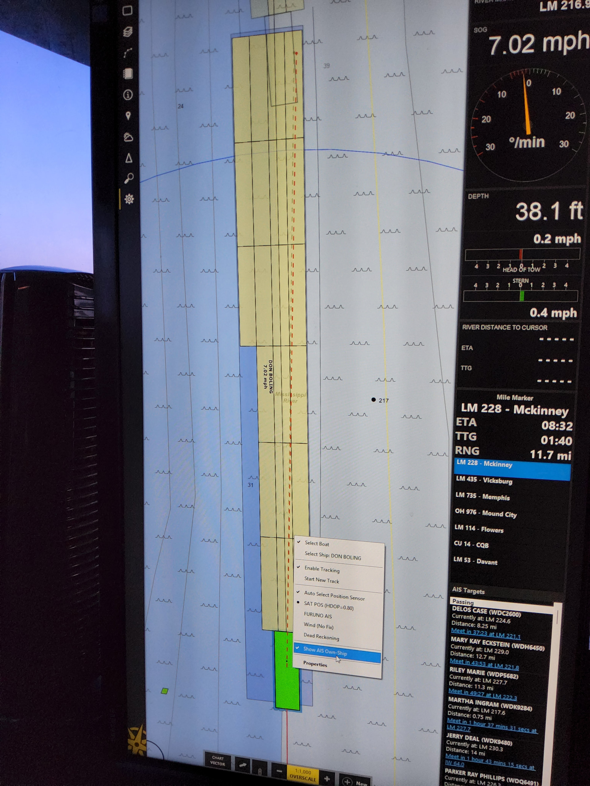
This old feature to show AIS Own-Ship I found very helpful to confirm that AIS vessel type was properly set and tow dimensions were transmitting accurately.
1 Like
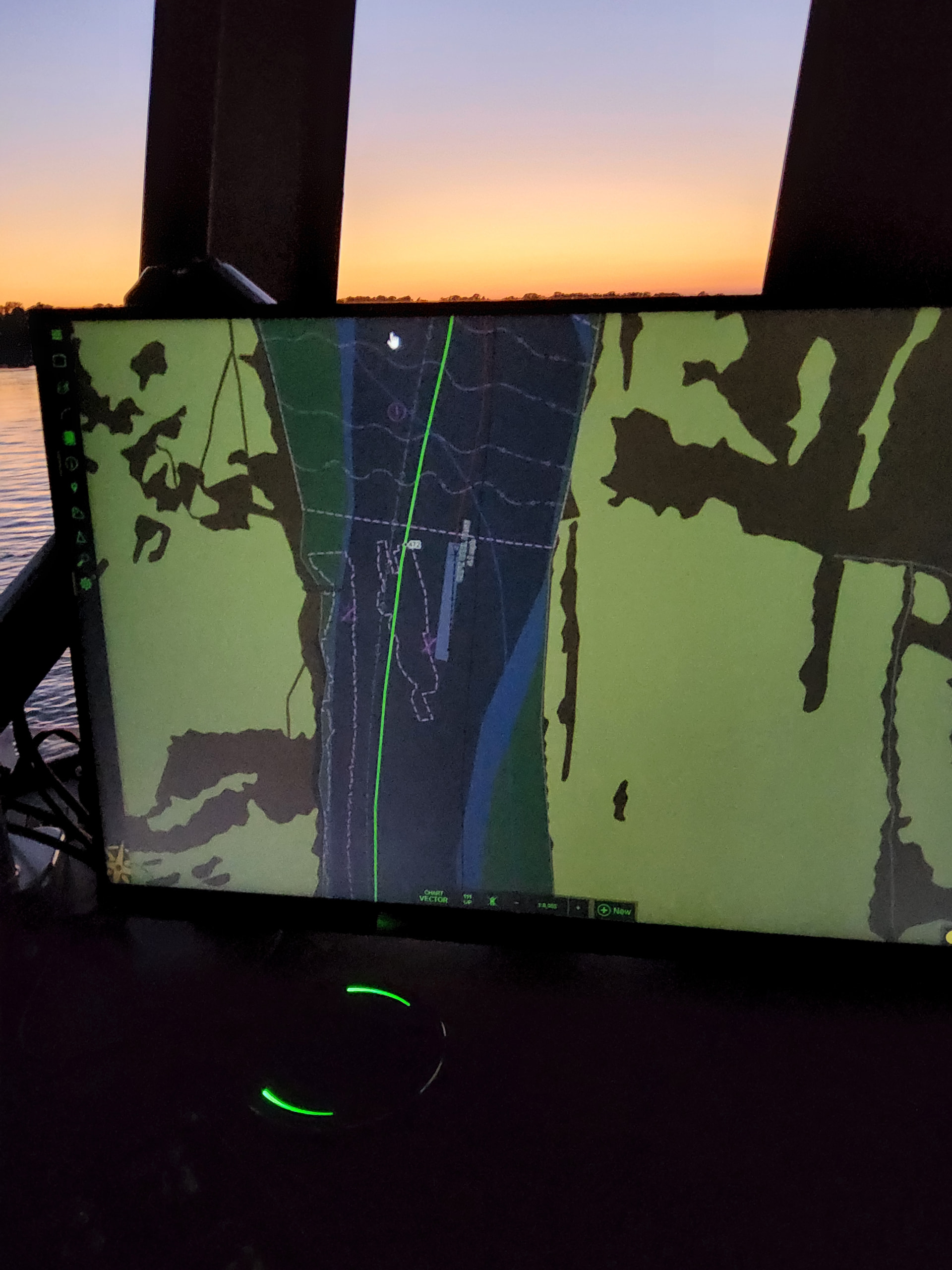
Some objects such as tows have very little contrast against the shallow river color making them practically invisible in dusk or night mode with the brightness turned down. Other objects such as mile markers and route line are distractingly bright. I have personally always desired an option to hide the voyage planned route altogether as we frequently run in different areas of the river based on the current stage and having a route line is just more clutter. An option to remove the highlighting around mile markers would be nice as well.
1 Like
It would be nice to be able to change colors of other vessels (individually) and attach notes.
1 Like
I second the route hiding after activating it for the route monitor. Love being able to get my updated ETAs without the route on the chart.
1 Like
Vessel info panels: We were not planning to include this unless someone asked, so I’ll add these to the list!
Mile Marker ETAs in the Route Monitor: I expect this will be done for the next update.
Show AIS Own-Ship: I’ll add this to the list as well.
Colors: I’m not sure what’s going with your mile markers as that looks a LOT brighter than what I’m seeing. I’ll see if I can figure out what’s causing that. It’s interesting that both of you want to be able to hide the active route…I haven’t heard that request before and the fact that we do hide the automatic river routes in v4 has been a source of complaints. But I’ll add that to the request list. Would it be good enough to just make the route a lot dimmer? If we let it be hidden completely, it’s not clear how you could show it again if you change your mind.
Vessel colors and notes: This is not likely to happen until v5…we have a TON of requests for controlling AIS vessel colors and all of those requests are different and mutually exclusive. It is going to take a lot of thought and some experiments to make everyone happy. Figuring that out is near the top of the v5 to-do list though. (And we will be adding the ability to attach notes and photos to vessels.)
1 Like
Maybe in route monitor there could be a C.R. Chart route button that you could click to switch the route on or off the chart, if not dimming might be the answer as you mentioned. When you address the vessel colors ideally I would hope that colors change in the company portal would be locked from being changed on the boats as I like to paint the different companies colors to quickly see what assets are in the local area. ( I call it fleet awareness)
Regarding pictures it would also be great to be able to add pictures to annotations as I have barge spotting instructions and a picture says a lot of words.
Thanks as always Bubba
Thanks so much Brad. I assume the glaring route line and low visibility comes from us running the monitor at super low brightness levels to save our night vision on dark nights. The contrast against the chart does seem to be different from previous version though. I don’t know if it’s feasible to add a general option to change other tow colors to a lighter blue perhaps?
For the voyage route line I suppose I envisioned a way to hide it as if it was a track, or “show/hide route” when starting a voyage.
Thanks for all you do.
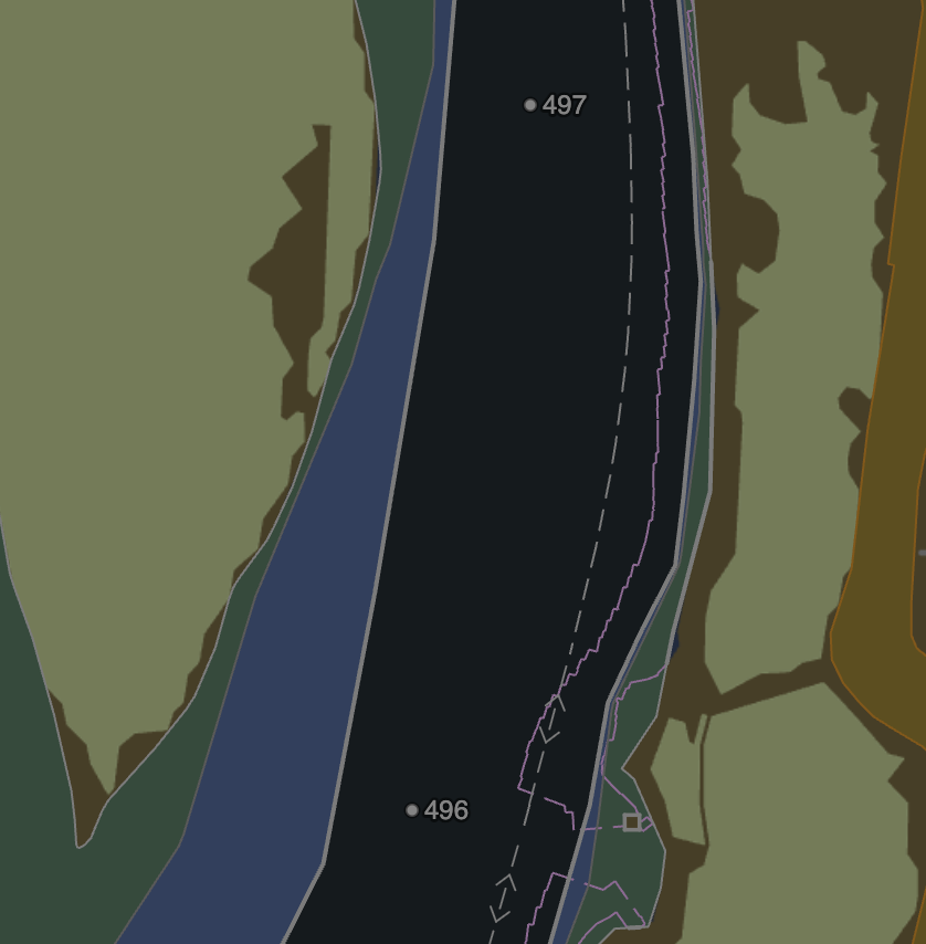
It turns out there was a bug in the mile marker code that was causing multiple copies of each marker to get loaded over time. This was causing the outlines to get brighter than they were supposed to be. I probably wouldn’t have figured that out without the screenshot since I noticed in it that your mile marker outlines were a LOT brighter than mine, so thanks for that!
That problem has been fixed for the next update, but we also inverted the colors in dusk and night modes so that mile markers look more like other text on the chart and I think that helps even more.
What do you think?
Well that looks great! Thanks a bunch.
1 Like
The route lines does seem to be even more glaringly aggressive as I turn the brightness down, like it’s not diming at same rate as everything else.
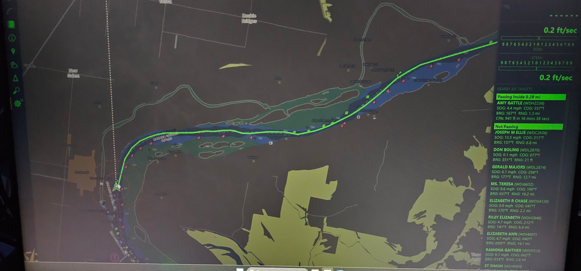
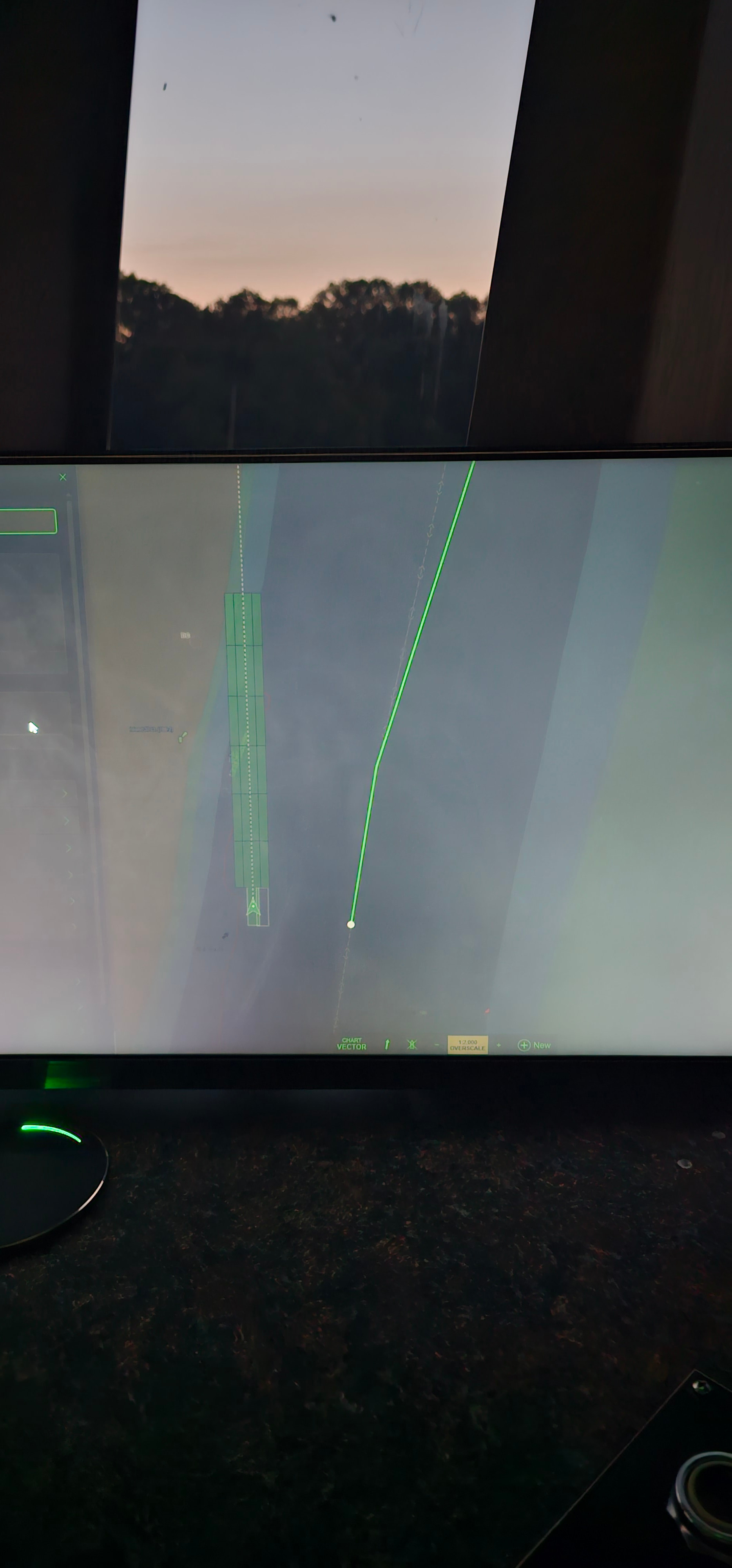
I love how much more legible day boards and light names are but for whatever reason I seem to struggle to see boat names as well with the new highlighted font. I sit about three to four feet away from my monitors and even with text sized increased it’s much easier to read the old style font.
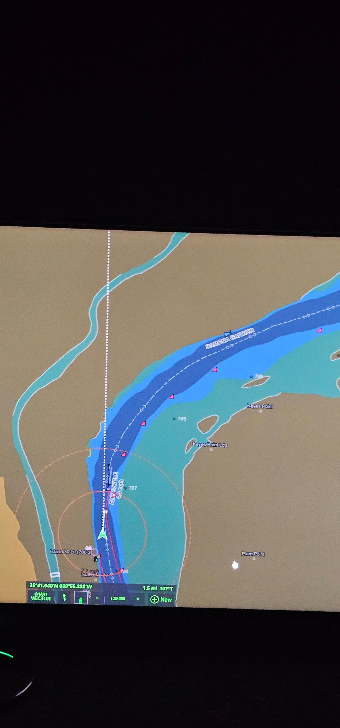
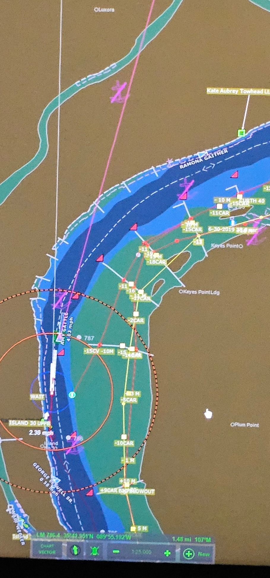
After crowd-sourcing some opinions, it seems like most folks I know are going to be turning off the additional details away from the river by clicking off the online charts and data option to keep the chart from being too busy. In the latest version, when this option is selected off, the part of the screen is a very pale white in dusk mood, if possible I’d recommend coloring it the same brown as the ground color as in previous version.
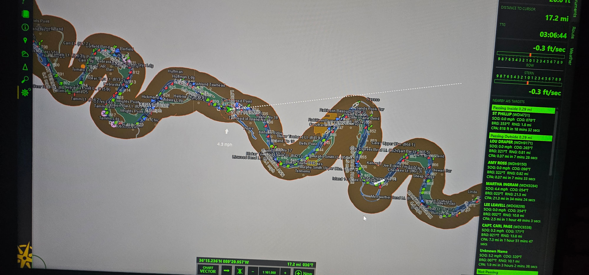
I’ll see what we can do about the color problems…I’m pretty sure we can make think work the same as in v4, or at least a lot closer!
Turning off the option to use online charts will disable a lot more than the extra detail on land; it will restrict charts and data to only what has been installed in the PC. That might be fine for some purposes, but if all you really want to do is turn off the additional land area details, there is an option just for that at “Settings > Chart Display > Vector Chart Display > Enhanced streets and other features”.
2 Likes
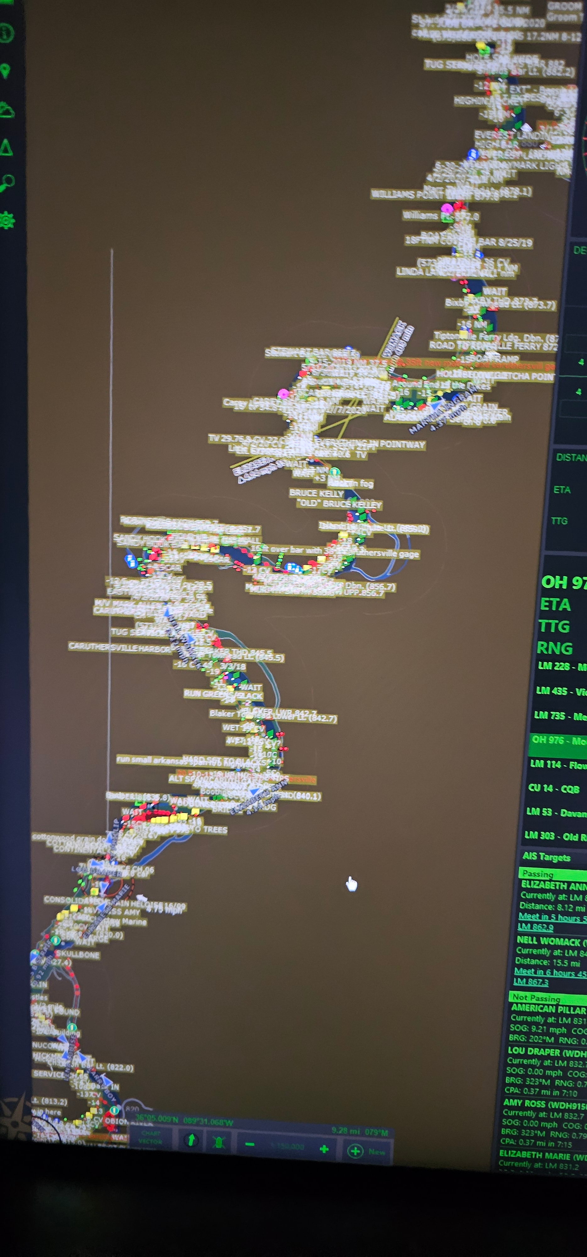
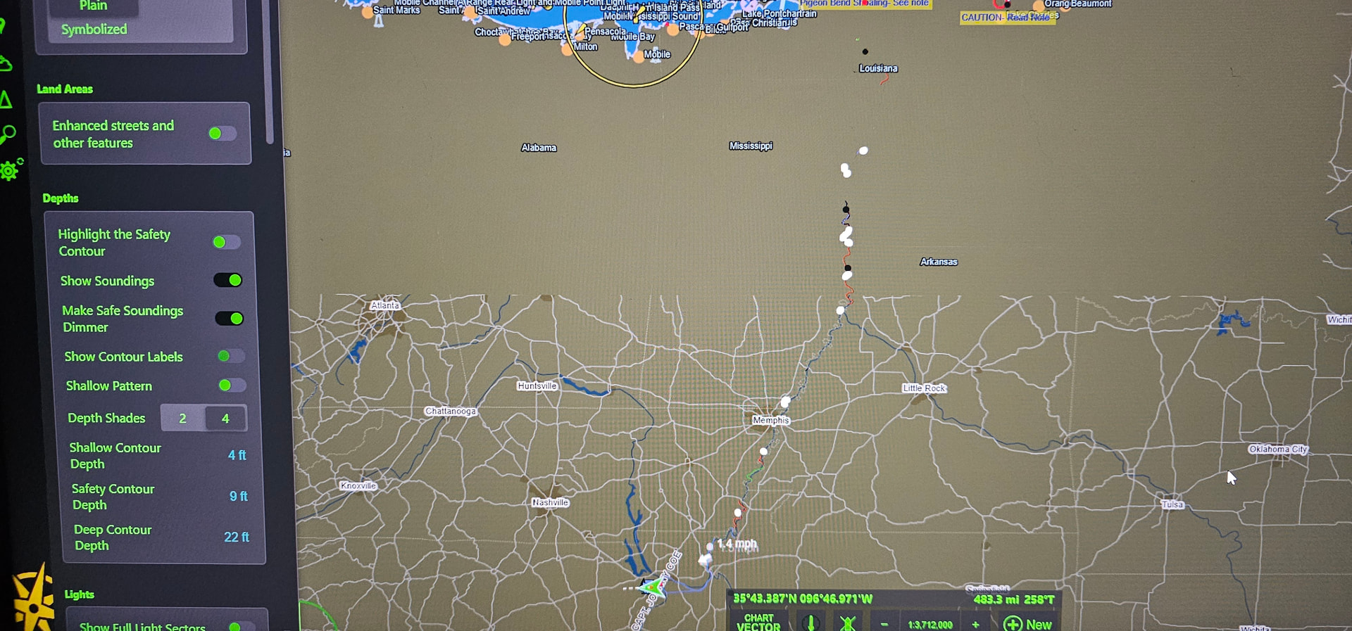
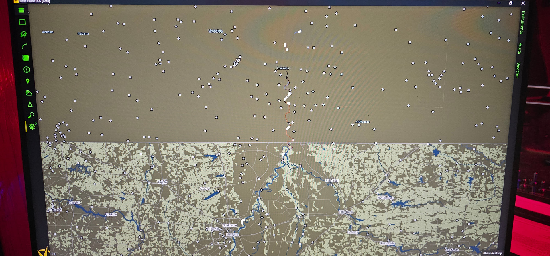
Hey Brad, lastest update feels great. I did discover that turning off the enhanced streets/features looks perfect, but appears like it only actually removes the additional details below a certain latitude. Everything above about LMR 560 remains visible. Picture below is scanned way out to see the break. Thank you.
1 Like
The program always draw the street map “under” the vector charts because there would be nothing for reference in much of the world otherwise. All the “enhanced streets and other features” option really does is stop filling in land areas from the vector charts so that the street maps “show through”.
That line near LMR 560 is the edge of NOAA’s small scale chart of the gulf coast. Above that edge, the USACE charts only include a small amount of land area around the rivers, so they don’t obscure much of the street map.
Maybe we can draw a much simplified map under the vector charts to provide some reference to where you are looking but with significantly less "clutter’. Would that address your concerns?
1 Like
Oh yes, I believe so. Thank you so much.
Thanks for putting the vessel info panels on Brad, could we possibly have them switch to a white on black color scheme in dark modes at some point? And not a big deal but I did notice that COG shows as “N/A” for all vessel info panels.
Also, I was wondering if it would be possible to display overall size of vessel/tow on pop-up when left clicking vessel, instead of having to go to details. Along those lines, if it’s not too much trouble it would be nice if we could right click on vessels to get straight to the menu with passing points/tracking etc.
1 Like